
MAPS
Visualize, manage, and interact with your entire facility through intelligent mapping. Click a category below to explore powerful mapping capabilities.
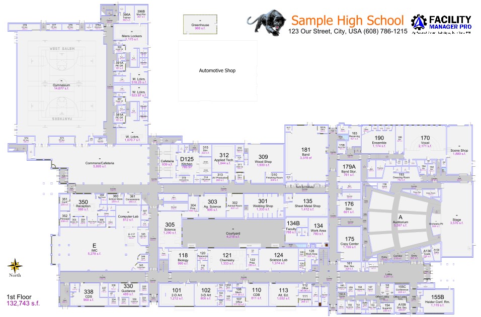
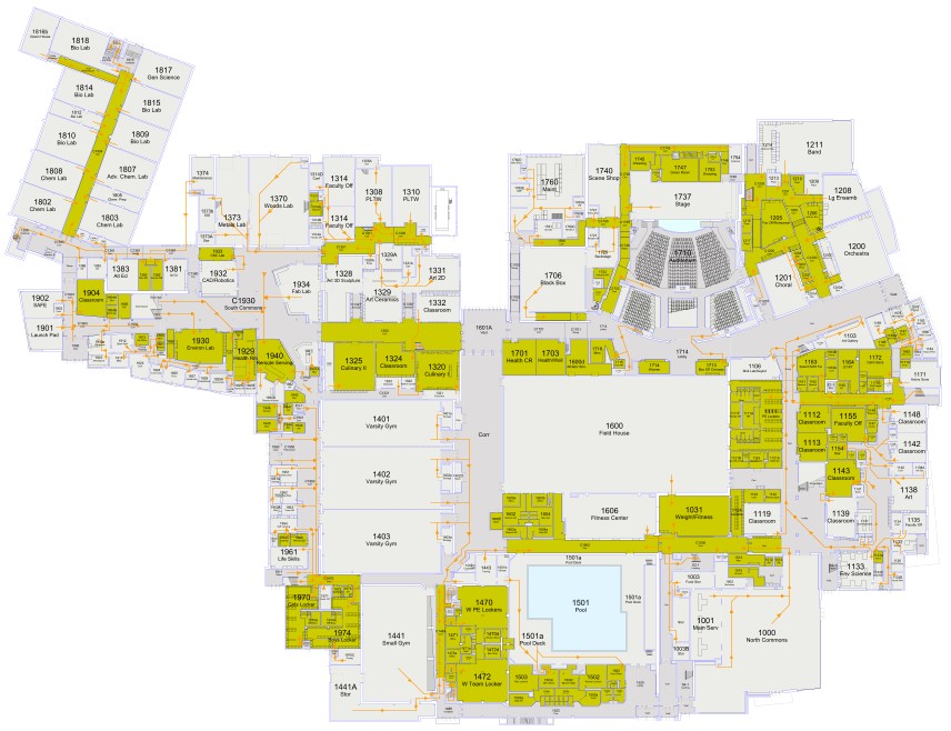
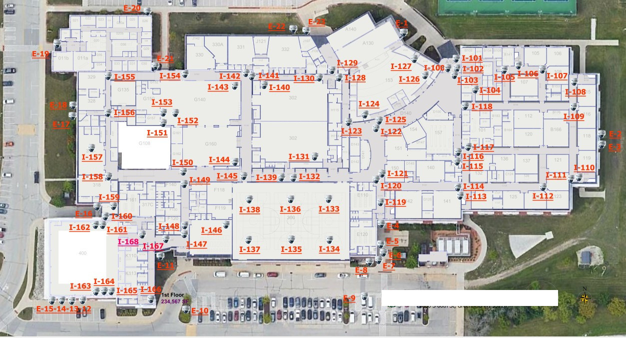
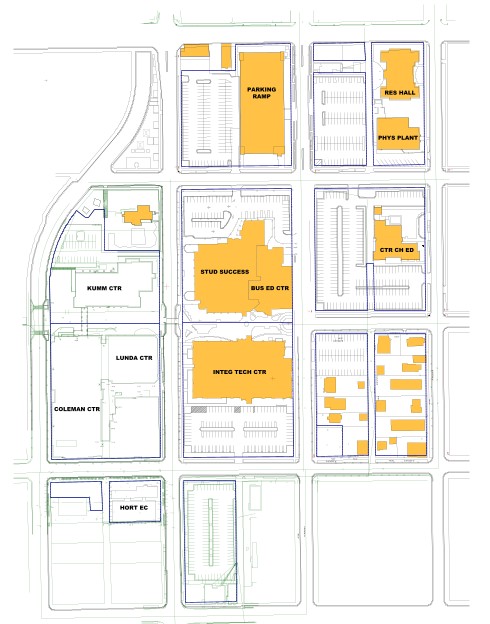
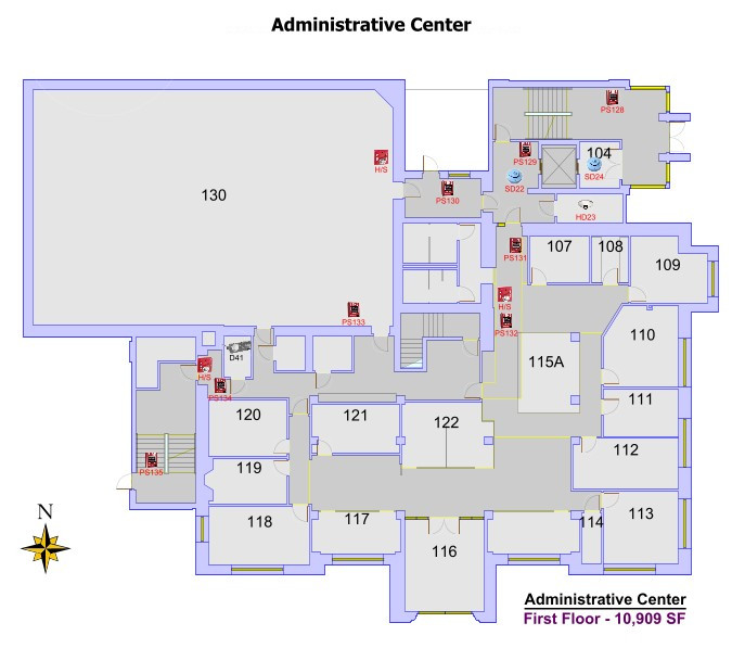
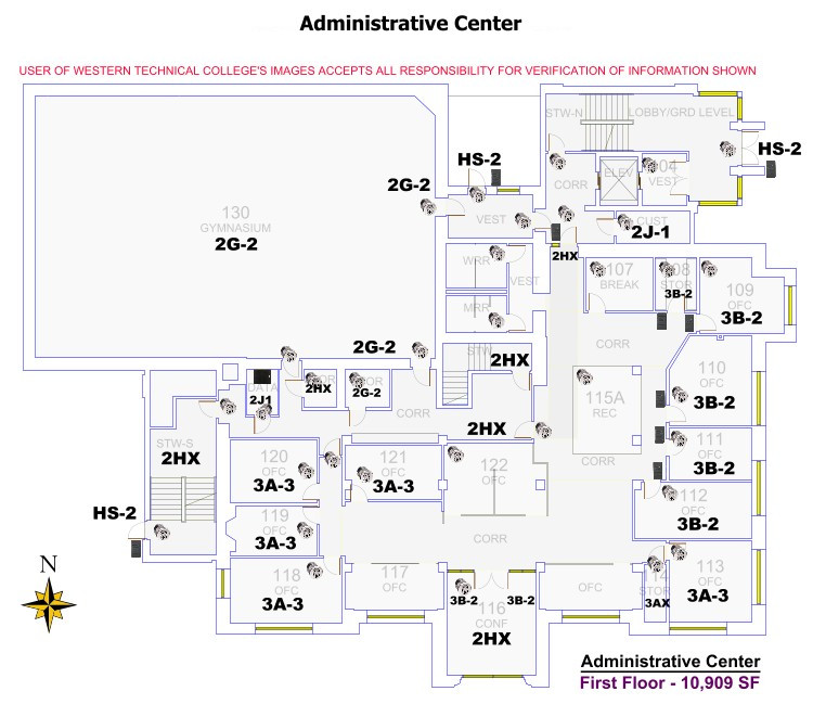
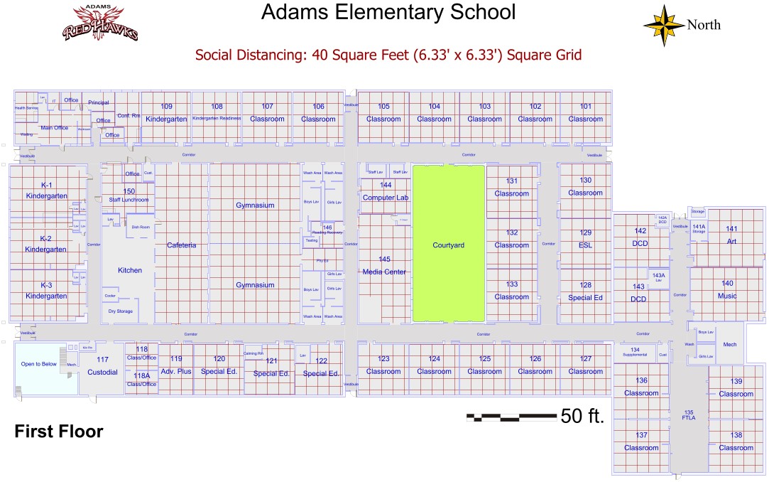
Floor Plans & Space Data
- Interactive floor plans with real-time data overlays.
- Accurate square footage tracking by room, zone, or building.
- Quick lookup for rooms, departments, and usage.
- Link assets, documents, and work orders directly to spaces.
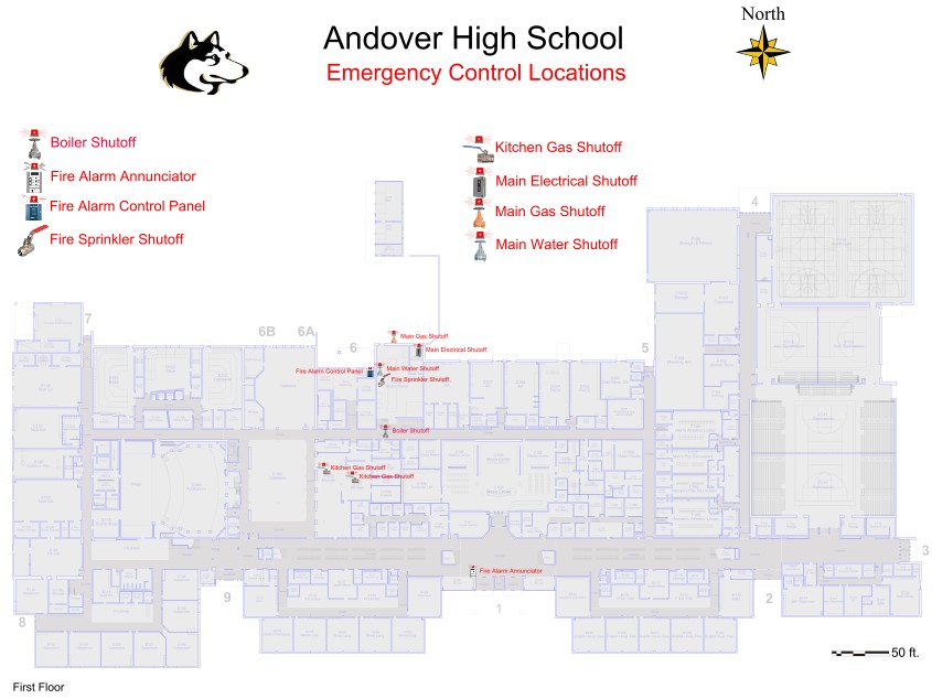
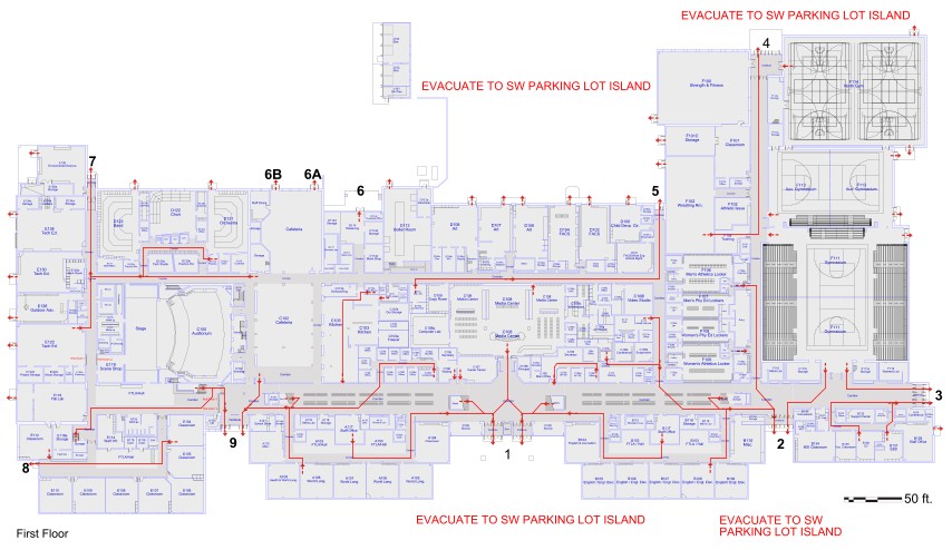
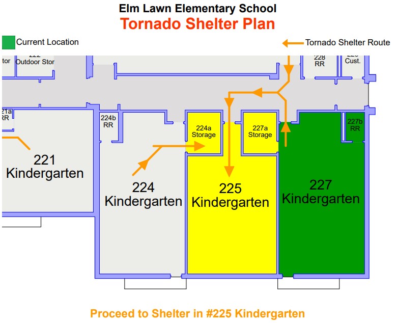
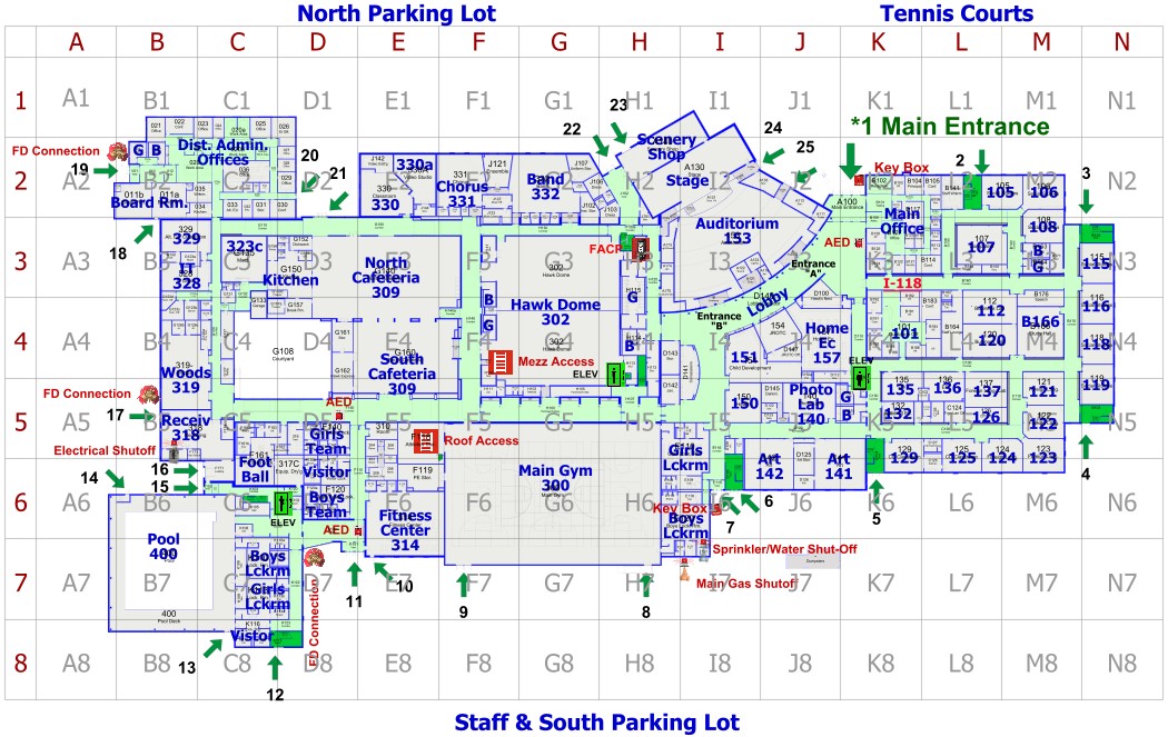
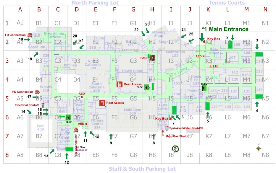
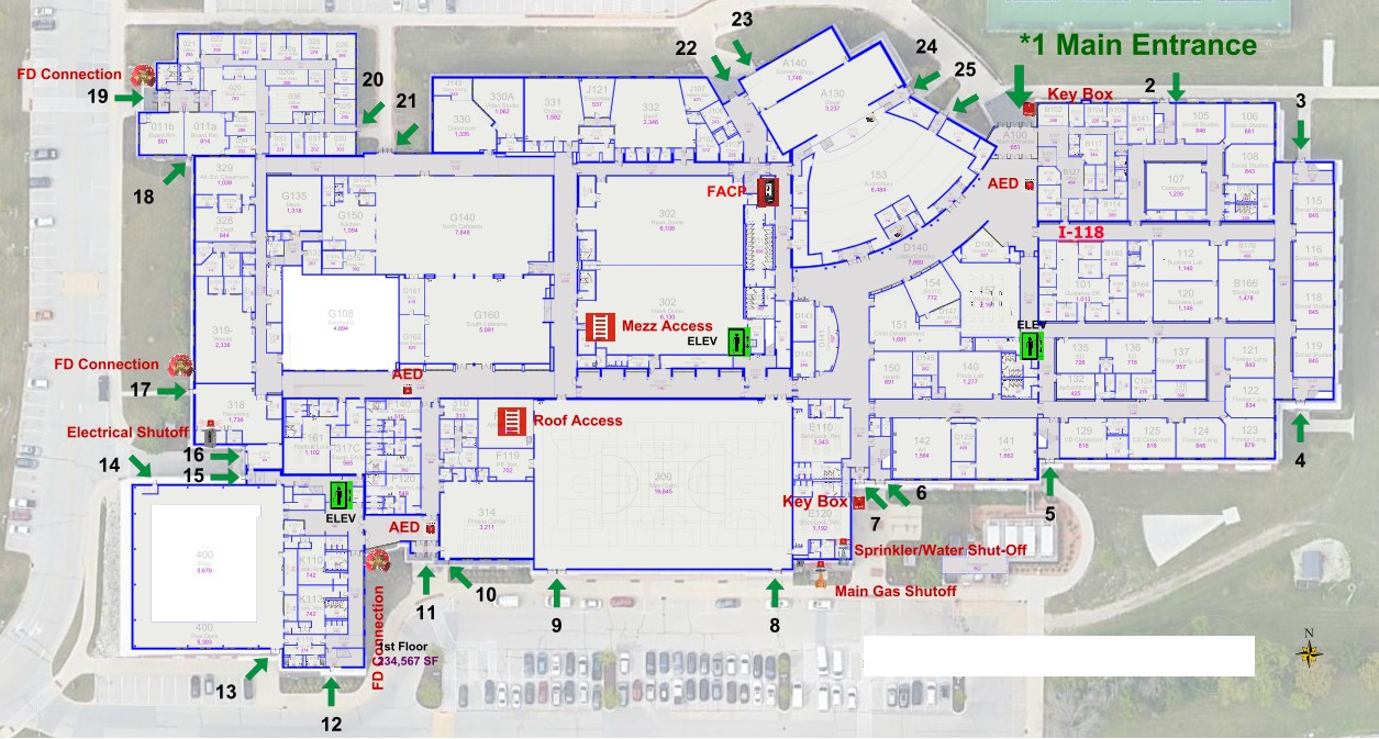
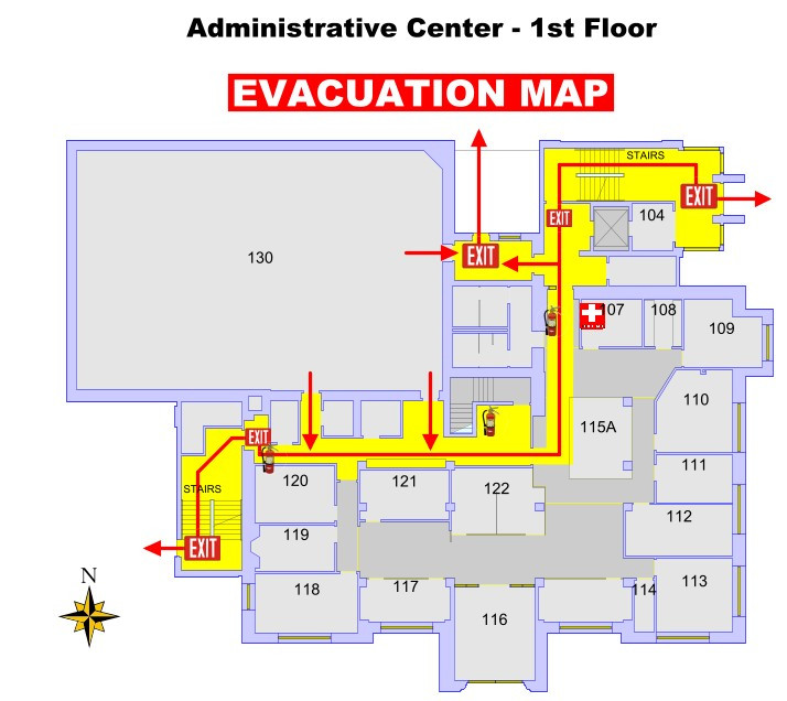
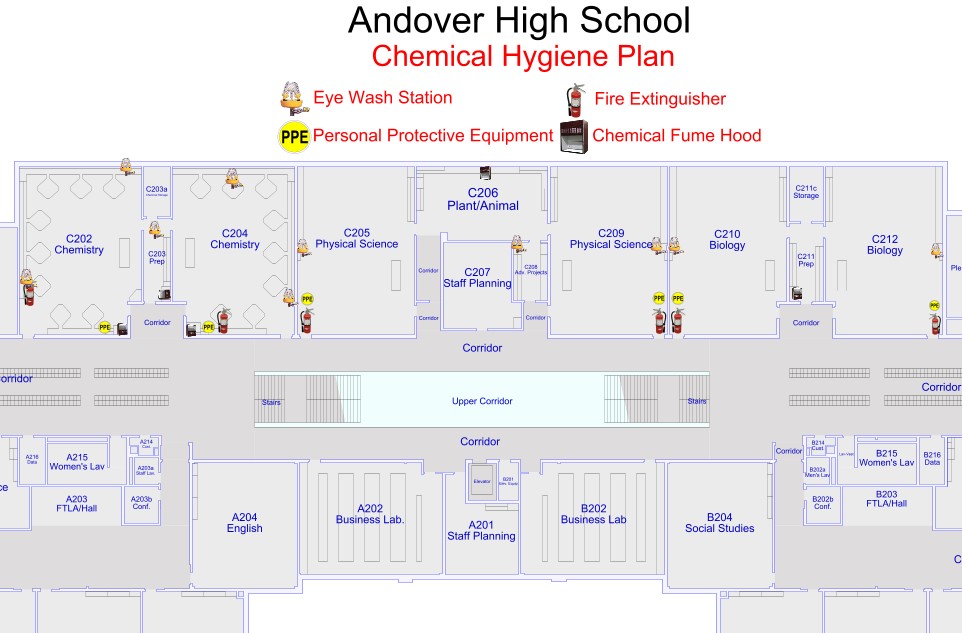
Emergency & Life Safety Mapping
- Map tornado shelters, fire exits, and evacuation routes.
- Locate fire extinguishers, AEDs, and safety equipment instantly.
- Provide first responders with critical building intelligence.
- Improve safety planning and compliance readiness.
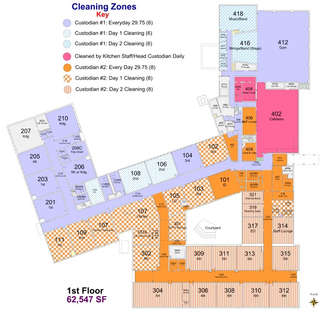
Custodial & Maintenance Zones
- Define and visualize cleaning zones across facilities.
- Assign staff responsibilities by mapped areas.
- Improve efficiency with route-based task planning.
- Track workload distribution and coverage.
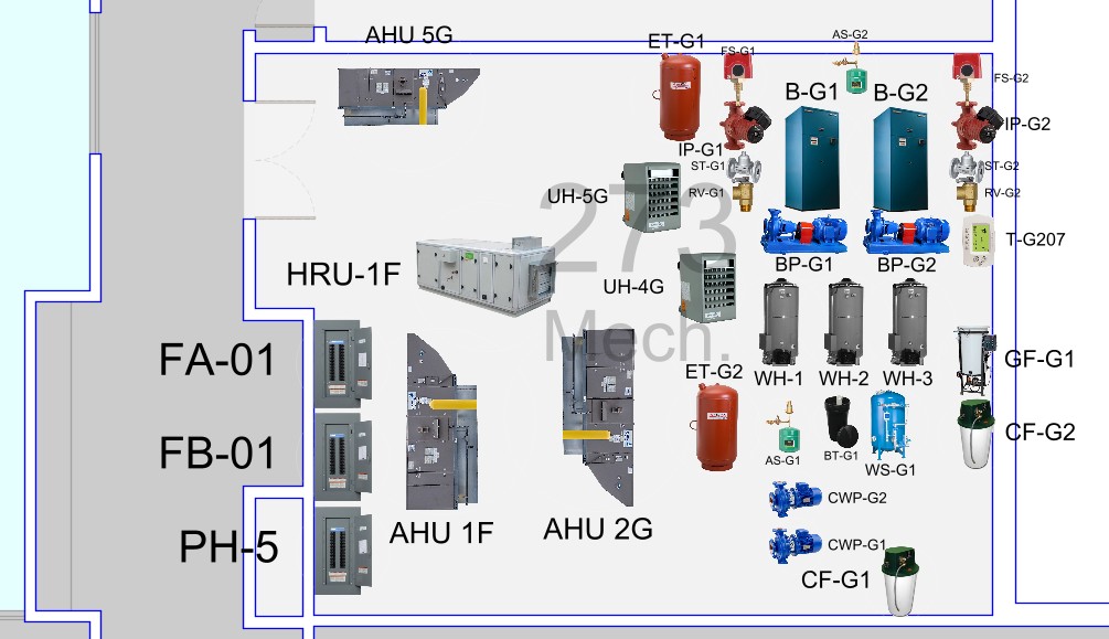
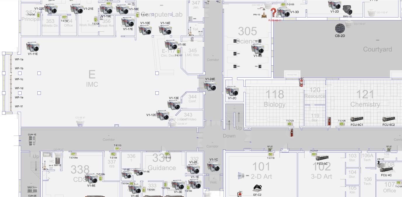
HVAC/PLMG/ELEC
- Visualize HVAC, plumbing, and electrical systems across your entire facility.
- Map critical components such as ducts, pipes, panels, and control points by location.
- Enable faster troubleshooting and response with system-based navigation.
- Improve maintenance coordination, safety, and overall infrastructure visibility.
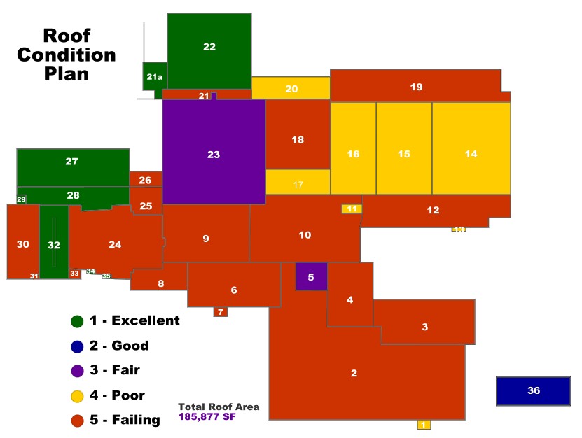
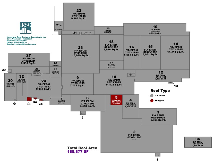
Roof Management
- Track roof age, condition, and warranty information.
- Plan maintenance and replacement schedules visually.
- Identify problem areas quickly using mapped data.
- Support long-term capital planning decisions.
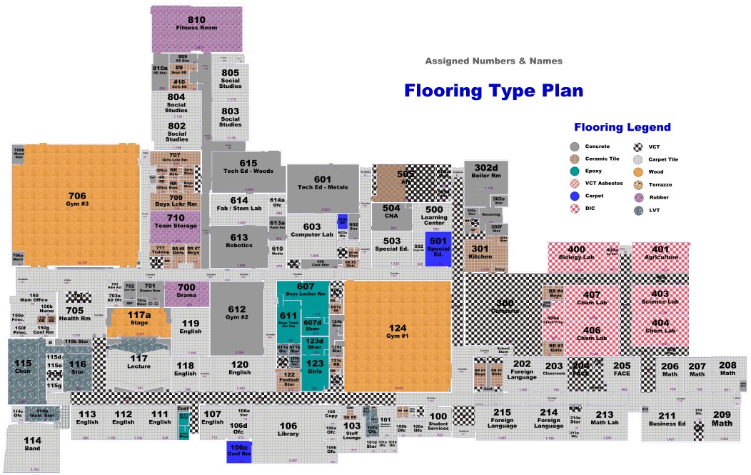
Flooring Management
- Track flooring types, materials, and conditions.
- Plan lifecycle replacements and budgeting.
- Identify high-traffic wear zones visually.
- Integrate flooring data with maintenance workflows.
Custom Data Layers
- Add unlimited custom data overlays to any map.
- Track utilities, IT infrastructure, and equipment.
- Centralize all facility intelligence in one place.
- Adapt maps to your organization’s unique needs.
With our Proprietary CAD, we can do numerous configurations to work with your floor, roof and site plans.
- Redraw/Create interactive floor, roof and site plans. These are based on square foot pricing, typically at 3/4 to 3 cents per square foot.
- Import your Architects current DWG drawings of your facilities, roofs and sites. This is based on an hourly rate per building which typically takes about 2 hours per building. Pricing at $75/Hour
- Import Image files of your blueprints so you have a background to work with. This is based on an hourly rate per building which typically takes about 15 minute per blueprint sheet. Pricing at $75/Hour
Did you know our proprietary CAD was designed from the ground up to be a management CAD system versus a construction/build CAD system like AutoCAD™. Our drawing elements are focused around attaching data base tables that provide a manager with all the information need to track and report on your job. Example: Attaching a measurement table to walls to calculate painting areas, flooring polygons for square footage/yards, roof areas with pitch calculation for accurate squares of roofing, etc. Custom image icons to represent objects that don’t have physical characteristics such as Asbestos, Lead in Water Samples, Roof Leak Areas, IAQ, etc.